

Cloud construction CRM and project management software for roofing and other trade contractors

Aerial imagery, measurement reports and property data for contractors, insurers, solar and public bodies
By EagleView

Eagleview collects aerial pictures at a very large scale, and the EagleView App is the route into that library for the professionals who use it. The company says its database holds more than 3.5 billion high-resolution images, and it combines them with computer vision to describe buildings and locations without anyone climbing a roof or visiting a site.
The imagery ranges from oblique to orthogonal views and from mosaics to patented high-resolution captures. The company says it has 20 years of experience supplying very detailed imagery, claims a higher resolution than satellite pictures and highlights building measurements it calls highly accurate. Reports can be downloaded as PDF, XML, JSON or DXF and imported straight into other industry workflows or third-party integrations.
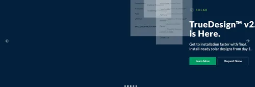
The range runs through Walls, TrueDesign, Inform, Bid Perfect, Cloud and Assess. Assess brings drone-powered property data and virtual inspections with damage detection software. TrueDesign produces install-ready solar designs from the first day, and its second version is announced. Walls reports add material breakout measurements for walls, windows and doors. Eagleview One brings imagery, analytics and agentic AI into a single workspace, and data packs, API documentation and developer kits are available for building on top of the data.
For contractors, aerial measurements support takeoffs, bids and project planning with less waste. Public agencies use up-to-date imagery for tax assessment, zoning enforcement, emergency response and infrastructure planning. Insurance carriers and claims adjusters use it to speed up claims and reach fair settlements, and Eagleview says 20 of the top 20 insurers rely on it. Solar companies use roof dimensions, shading analysis and obstruction data for system design. Utilities use aerial insights to monitor assets, vegetation encroachment and maintenance along power lines, pipelines and roadways.
The EagleView App gives access to the aerial imagery and property data produced by EagleView, a geospatial technology company. It combines high-resolution pictures with computer vision to measure buildings and describe locations without a site visit.
Construction, government, insurance, solar and utility customers. Insurers use it to speed up claims, and contractors use it for takeoffs and bids.
Summary written by TrustList from the business's own published information, Nov 2026.
Used it? Your experience helps other buyers decide.
Write a reviewNo questions yet. Be the first to ask about The EagleView App.
Similar listings buyers compare against this one.
Cloud construction CRM and project management software for roofing and other trade contractors
Cloud business management and back-office software for roofing companies

Roofing software for measuring, estimating, contracts and payments, built for small crews and solo roofers

All-in-one cloud business software for pool, fence and other construction contractors

Web-based CRM and project management software for roofing and specialty trade contractors

Business and technical software for roofers, carpenters and roof plumbers in Germany
Aerial roof measurement reports and estimating tools for roofing contractors, architects and engineers
Articles that share the Android tag or mention this listing.
 Italy
15 Nov 2026
The Garante says the gallery suggestions feature, on by default since 2023, read photos and videos of about 20 million Italian Android…
 United States of America
3 Nov 2026
The most severe flaw lets an attacker run code with no user interaction, and a critical bug in WAP Push SMS handling, with a public proof…
 Redmond, Washington
29 Oct 2026
CVE-2026-80097, rated 8.6 by Microsoft and fixed in Authenticator 6.2606.4246 in September, let an Android app with no permissions request…
Everything here links back to the same verified catalogue. Pick your next stop.